Walking in the Rain, On a Resilient Street
It rains a lot in Houston. In fact, May-October is considered monsoon season. As a city founded at the intersection of two bayous, when it rains, streets are often awash. Sidewalks provide critical travel options for pedestrians and people with disabilities within the public right-of-way (ROW); they’re the connective tissue in a typical community. If there are no curbed sidewalks, people with mobility limitations are pretty much stuck. In Houston, that’s on and off for six months!
So this summer, the City approved “Citywide Toolkit and Resilient Community Sidewalks Plans.” Two Sidewalk Plans focus on the communities of Gulfton and Kashmere Gardens, and the Citywide Toolkit offers solutions that are replicable for streets throughout Houston. The Plans meet six main goals:
- Create a safe, reliable and equitable pedestrian network
- Address flooding and conflicts between drainage and accessibility
- Provide recommendations that incorporate multiple benefits
- Develop scalable and replicable solutions that can apply across neighborhoods citywide
- Build on past and concurrent citywide efforts
- Identify funding, implementation and maintenance strategies
The City chose to focus on two specific communities with the greatest needs, that have historically experienced underinvestment.
Gulfton. As one of the most diverse neighborhoods of Houston, nearly 36 miles of Gulfton’s streets have either no sidewalks or sidewalks in very poor condition. It’s a culturally diverse and international community, home to 40,000 residents with more than 50 spoken languages. Located just outside of Loop 610, south of US 59 in Southwest Houston, it has the highest population density in the City.
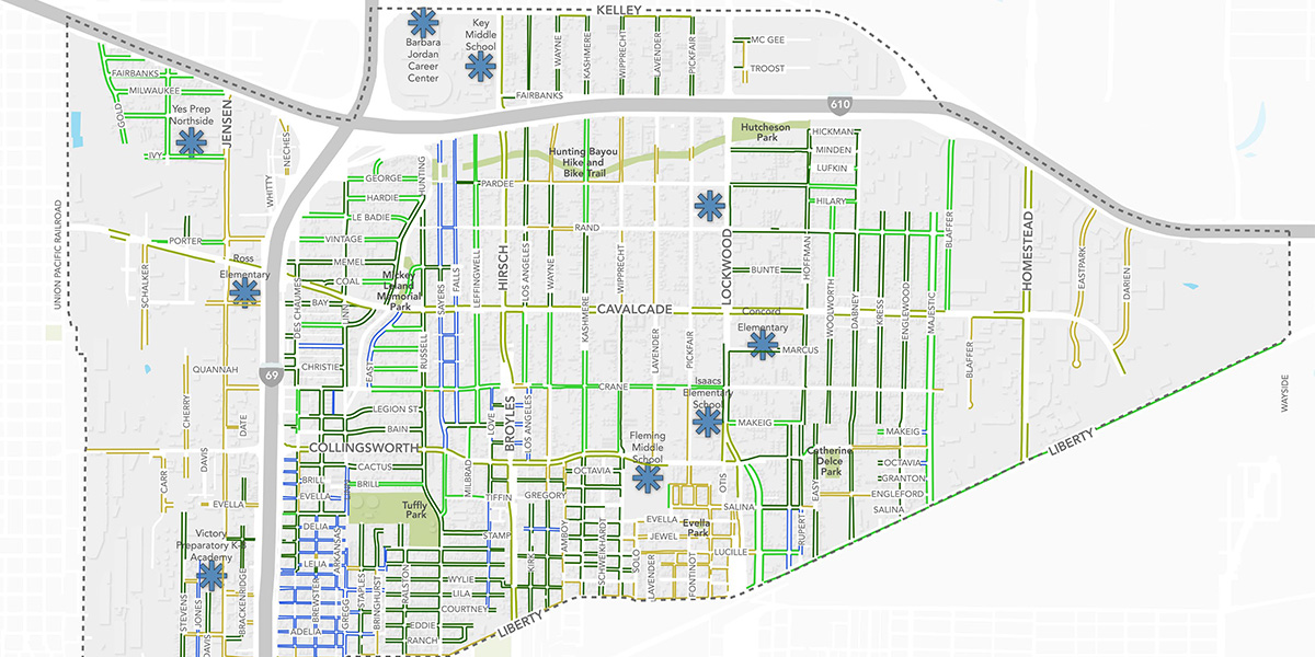
Kashmere Gardens. The neighborhood is mainly single-family homes, but only 30% of its streets have sidewalks. It’s a historically African American neighborhood, located in the northern area of the 610 loop. In 2017, the area suffered severe damage from Hurricane Harvey—79% of all homes in the area were flooded—and about 40% of the community's residents are living in homes that still need remediation.
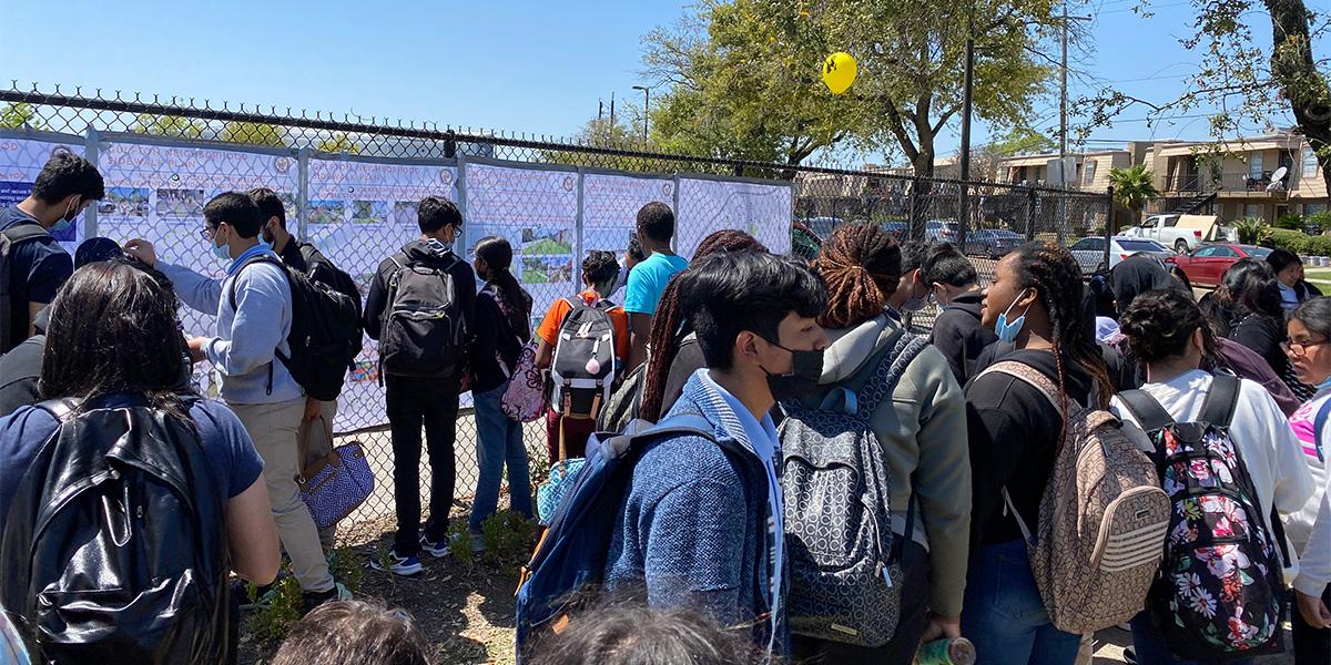
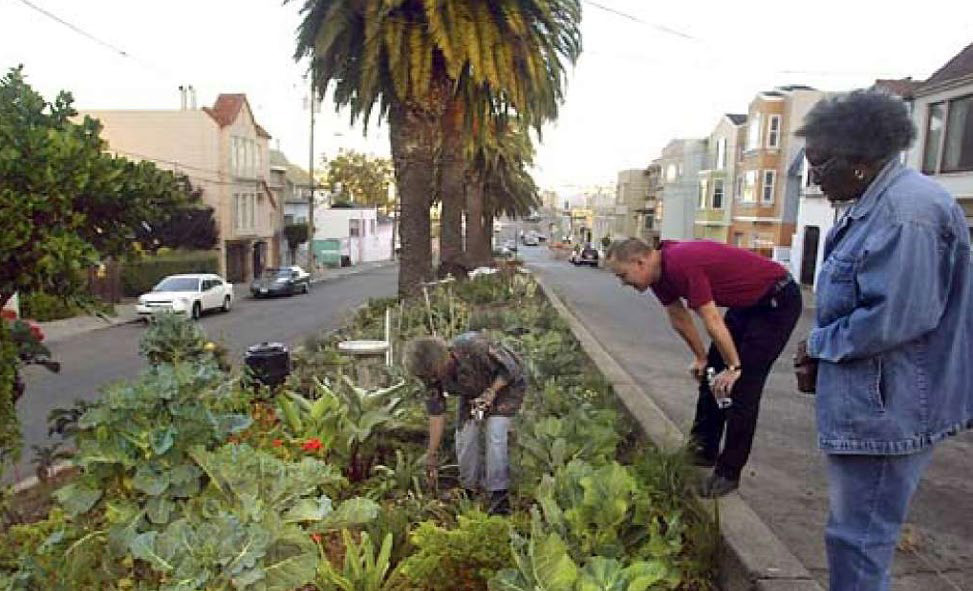
MIG worked with the Gulfton and Kashmere Gardens communities in a robust public engagement process. Tools and activities like a website, interactive community workshops, online and paper surveys, and in-person events provided options for community members to participate in a manner that was convenient and comfortable for them. Residents and businesses helped review and affirm proposed design concepts for the sidewalk and drainage improvements that were highest priorities for them.
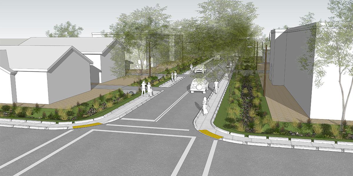
Although each community has its own plan, there are many common elements. These solutions will help create a “resilient pedestrian network” that allows communities to recover more quickly after a disaster, with improved access to essential services such as groceries and health care.
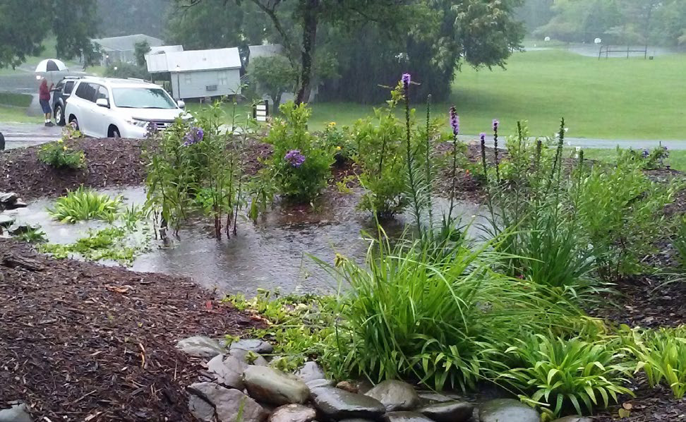
Drainage and Flood Mitigation Elements
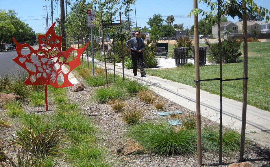
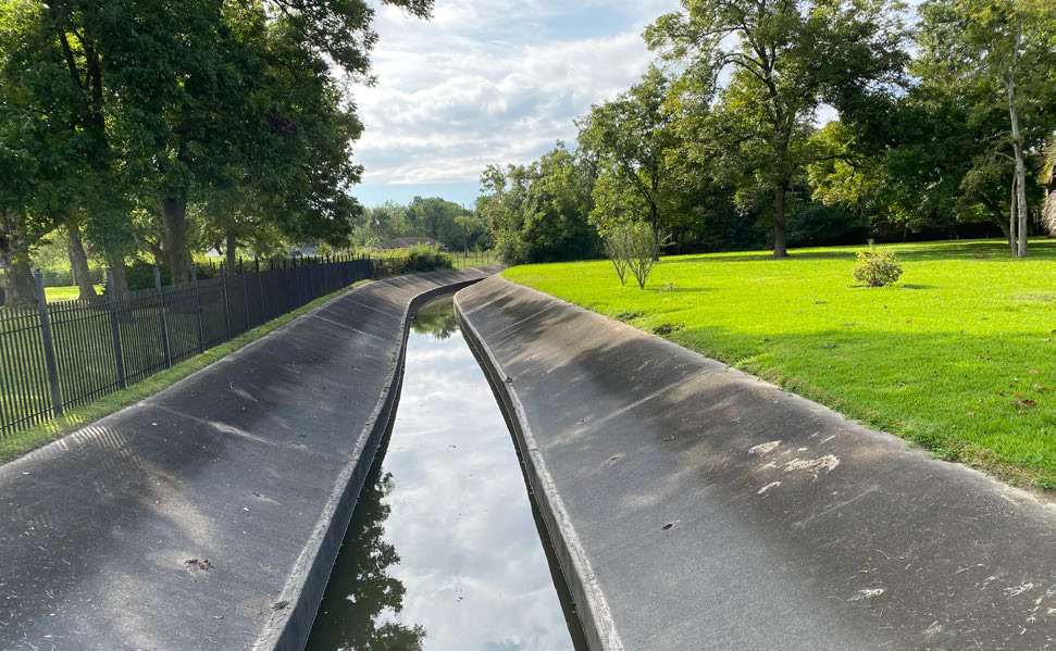
The facilities can include stormwater planters to capture water (include shade-producing trees and shrubs), permeable street paving, bioswales (including vegetation to improve water quality and mitigate runoff), rain gardens (to temporarily hold water and add beauty), landscaped drainage channels (away from roadways) that can move large amounts of water and other streetscape elements (like planted traffic circles and curb extensions) that also maximize pervious surfaces and encourage traffic calming.
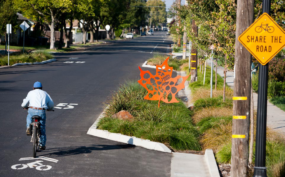
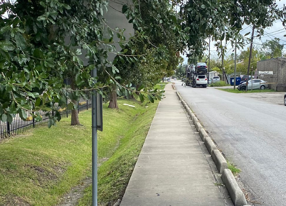
Sidewalk and Pedestrian Improvements
The improvements can include wider sidewalks, raised and/or buffered sidewalks that provide an ADA-compliant walking path, raised and separated sidewalks with a landscaping buffer to protect pedestrians (can include trees), bike facilities that further separate sidewalks from traffic, improved existing crosswalks and adding more crosswalks, street and pedestrian lighting, and improved bus stops with shelters and lighting.
Community Identity and Resilience Elements
These include equitable access to health and affordable food (edible landscapes and fruit trees in the ROW), spaces to celebrate community art, natural elements to create a distinct sense of place (art installations, stormwater planters that beautify the community) and wayfinding signage.
Citywide Applicability
The plans include maps showing where and what types of short-term and long-term improvements could be made in each community, based on the existing conditions on each type of street. City staff, developers, community members and partner agencies will use the scalable and replicable elements as a guide for selecting the most appropriate sidewalk and drainage solutions for both existing and new streets—creating a “resilient pedestrian network” throughout Houston.